Walking
Ordnance Survey Explorer Maps 140 and 141 cover the whole of the Avalon Marshes and show rights of way and other useful information, but please be aware that we do not maintain these Public Rights of Way, which can sometimes fall into disrepair, with some routes overgrown or impassable, especially during the summer, particularly those that are not regularly walked. Any such faults should be reported to Somerset County Council.

Nature Reserves - Trails, Paths and Hides
On the nature reserves you will find many paths, trails and boardwalks which are maintained by the partners. Ham Wall, Shapwick Heath and Shapwick Moor are linked by walk routes from the Avalon Marshes Centre. Whilst not essential our map will take you to trails and hides that you might not otherwise find. Either download a copy from our Maps page or pick one up at the Avalon Marshes Centre.
Heritage Walks
These circular walks will take you away from the nature reserves and into the surrounding countryside using public rights of way and permissive routes – click on the links below to download copies. However, please note these routes were designed 10 years ago and are no longer checked by us, so do bear in mind the statement above in bold regarding footpath access issues and fault reporting.
A Wander Around Walton & Small Moor
Easy 2.5 miles (3km)
This short walk takes you from Walton around the edge of Small Moor to Sharpham Park. Small Moor lives up to its name with its small meadows bordered by willows and rhynes.
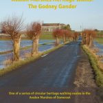
DownloadThe Godney Gander
 Easy 3 miles (5km)
The “island” of Godney is the focus of this short walk which gives a real feel for the marshes’ character of meadows, wet hedges, willows and simple architecture. The walker is reminded of troubled times with views of World War II pillboxes.
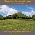
DownloadGlastonbury Tor to the Old Oaks
 Moderate 3.5 miles (5.5km)
This walk takes in wonderful views from the top of the Tor to the ancient landscape of the old oaks, Gog and Magog, and the historic hedges of Stone Down Lane.
Download
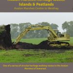
Islands & Peatlands
Easy 3.5 miles (5.5km)
This walk explores the peatlands and islands around Westhay. Starting at the Avalon Marshes Centre the walk explores the landscape of the “honey” trackways, Burtle islands and Parliamentary enclosures. Route can be extremely muddy in winter and overgrown in summer, with livestock in some of the fields. Waymarking issues have also been reported between #6 and #9.
Download
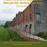
Wearyall Hill, Beckery and the Brue
Moderate 4 miles (6.5km)
Starting at the Red Brick Building in Glastonbury this walk includes industrial heritage and ancient legends. Wearyall Hill gives fine views of the Tor, the Avalon Marshes and the hills beyond.
Download
Baltonsborough, Butt Moor and the Brue
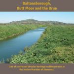 Moderate 4.5 miles (7km)
Starting in the historic village of Baltonsborough this walk takes you out onto Butt and Kennard Moors via a lovely wooded path. The return leg is along the open landscape of the River Brue. Note that part of this route gets very overgrown in summer, and the last part of the walk now goes through a housing estate.
DownloadWedmore, Wetlands and Sand

Moderate 4.5 miles (7km)
This walk starts in the historic village of Wedmore and takes you onto Aller Moor with its many rhynes and interesting wetland natural history. On the return leg you pass Madwoman’s Lane and the hamlet of Sand. Can be very overgrown in places in summer.
DownloadMounds & Moors
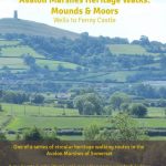 Moderate 5 miles (8km)
This walk will take you from the outskirts of Wells to Fenny Castle with its Norman motte & bailey castle. There are other interesting historical features on the route.
Please note there is a slight error in the directions at #13: the words “where you will find a large stone bridge” should be deleted. Also note that the Fenny Castle Tea Rooms are no longer trading. Other recent issues reported include: removal of waymarking, with crops and an electric fence blocking access between #3 and #5.
Download
Romans, Rivers & Railways
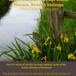 Moderate 7 miles (11km)
This walk takes in the attractive and historic villages of Chilton Polden and Cossington, the “high” lands of the Polden ridge and explores the landscape of Roman saltworks, the Somerset & Dorset Railway and Gold Corner pumping station.
Please note that during the summer months the bridleway between #4 and #5 may be very overgrown and virtually impassable, and it is recommended walkers seek an alternative route to Gold Corner.
Download
Rhynes & Rare Breeds

Moderate 6 miles (9.5km)
This walk takes in the attractive stone villages of Catcott and Shapwick and the nature reserve of Shapwick Moor. A feature of this walk is the Nidons ridge with its fine views over the marshes. Please note that various access issues have been reported between #6 and #8.
DownloadMarshes & Mendips
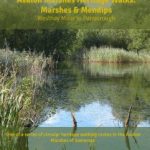 Moderate 6 miles (9.5km)
This walk links the National Nature Reserve of Westhay Moor to the high lands of the Isle of Wedmore. One of the highlights of the walk is the panoramic views from Hare Acre Hill.
Please note that there are currently a number of access issues with this walk to the north of North Chine Drove (#4), and it is recommended that walkers seek an alternative route via adjacent lanes, avoiding these footpaths, to reach the view from Hare Acre Hill (#7).
DownloadMark's Ditches & Droves
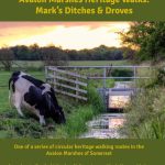
Moderate 7 miles (11km)
Starting in the attractive village of Mark, this walk takes you over Mark Moor with its landscape of straight lines formed by the droves, rhynes and ditches which cross-cross the landscape. Brent Knoll is a constant backdrop.
Download