Water and Drainage
1:25000 TILE ST34
Water is at the heart of Avalon Marshes landscape. Once sea, it has gradually become land through a succession of saltmarsh, freshwater wetlands and associated habitats. From Roman times man has diverted rivers, drained bogs, lived with regular flooding, constructed pumps and sluices, and built sea defences. Why has so much effort been put into an area which lies at or below sea level? The answer is primarily the rich summer grassland created from the peats, clays and silts, enriched by the water which irrigates it. Today water management is also vital to conserve the area’s rich wildlife and buried archaeology.
Tidal Range and Sea Level
To understand water and drainage in the Avalon Marshes it is necessary to understand the influence of the sea and tide. The Severn Estuary at 15m (48 feet) has one of the largest tidal ranges in the world. Most of the Avalon Marshes (“the moors”) is generally 3-4 metres above mean sea level (or ordnance datum), approximately half way between the high tide level and low tide level… Many areas therefore lie below high tide level, especially at times of spring tides when they are at their highest.
The Levels
The Avalon Marshes is protected from daily flooding from the sea by a combination of sea defences, such as sea walls, and the slightly higher coastal clay belt, known as “the levels”.
A Land Left Behind
As sea level has risen through the centuries, and sea defences have been improved, the land has been “left behind”. It is no longer rising in the same way it did when the sea penetrated inland bringing more silt and clay. Hence, over the centuries, good drainage has become increasingly important. However, drainage also causes the ground to shrink and the land becomes even lower!
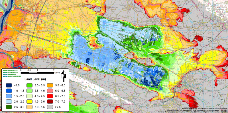
Land levels: dark blue is the lowest, red is the highest – Somerset Drainage Boards Consortium
Drainage and water supply – Field to sea
Grips
If you look across many meadows in the Avalon Marshes you will see a network of shallow channels running across them; these are grips. They were cut to improve drainage and help water run-off into the ditches surrounding each field.
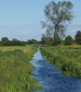
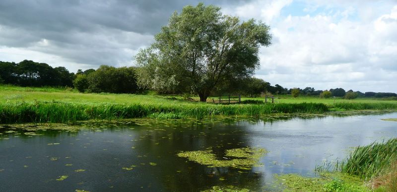
Old Rhyne, Aller Moor
Ditches (Wet Hedges)
Ditches have several functions: they drain water away, act as “fences” to keep stock in (hence the term “wet hedge”), and in summer irrigate the land, which is important for agriculture and wildlife.
Rhynes
There is no hard and fast rule when a ditch becomes a rhyne but they are generally larger and more important water carriers. Those which are particularly important are termed “viewed rhynes” and are maintained by the Internal Drainage Board rather than individual landowners. Rhynes generally connect with the drains
Drains
North Drain – Joy Russell
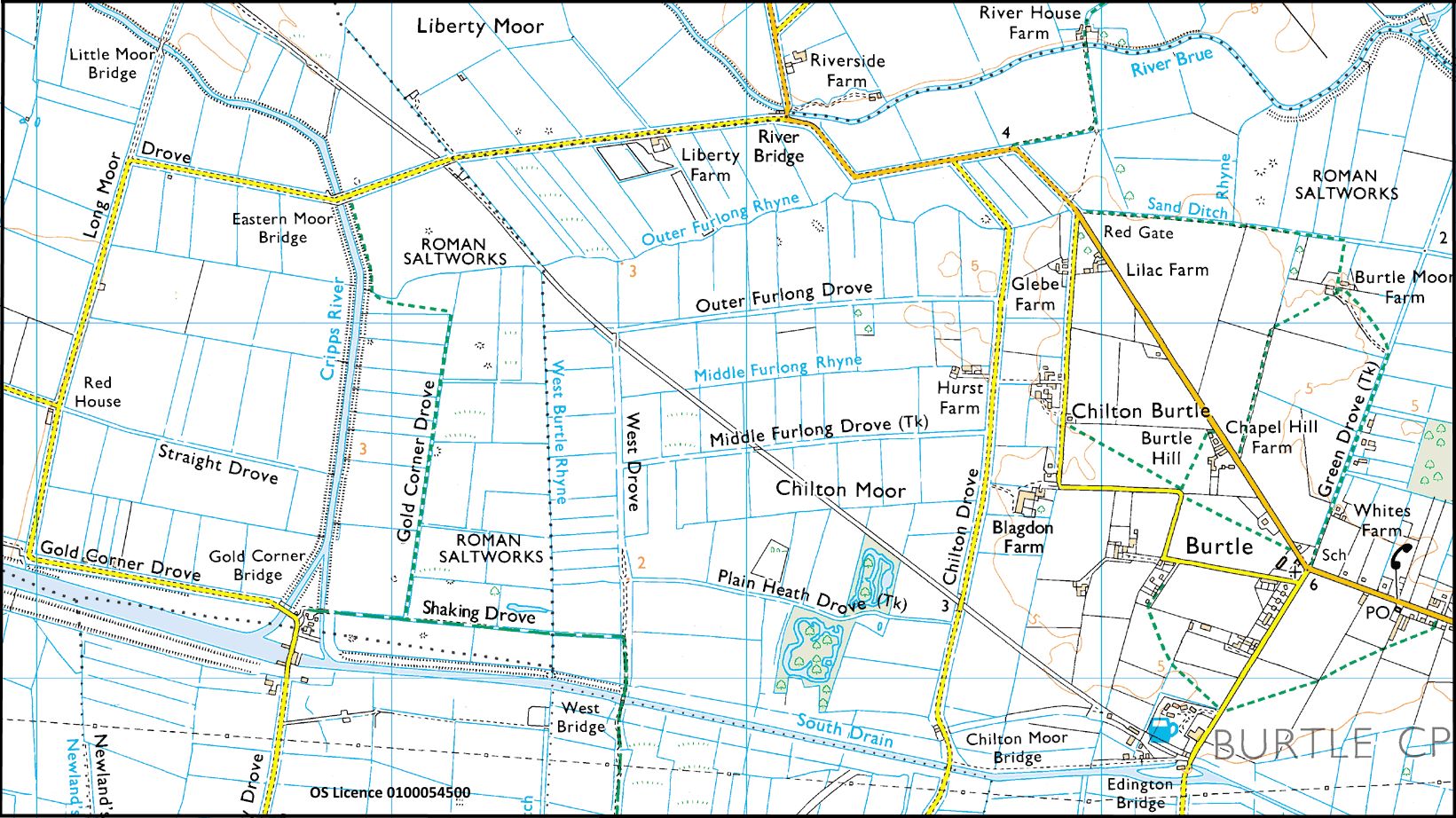
There are two main drains in the Avalon Marshes, the simply named North Drain and South Drain. These are large, artificial “canals” or channels which cut straight across the landscape and which can carry large quantities of water. The North Drain starts from near Godney and can be pumped into the River Brue just north of Burtle. The South Drain starts near Street and ends at Gold Corner, where it can be pumped into the Huntspill River or can flow by gravity via the Cripps River into the River Brue.
Rivers
Look at the map and you realise that the Huntspill River and the River Brue are not natural rivers but artificial channels cut by man not by nature. In the case of the River Brue, built in medieval times, the channel is higher than the moors. It is a”high level carrier” which conveys water from the high lands of the east across the marshes to the sea. In contrast the Huntspill River was built in World War II to supply water to the Puriton Ordnance factory. However, its design also made a huge improvement to the drainage of the Avalon Marshes.
The River Sheppey rises near Shepton Mallett. Once it reaches the marshes it partly follows its natural course, meandering across the area before becoming the artificial James Wear River. The Whitelake River is similar; it meanders its way from the Pilton area and then becomes the straight Hartlake River before joining the Sheppey at Godney.
Water Supply
This system is not just about drainage but water supply too, as many parts of the network can also be used in reverse. As with drainage this requires careful management and co-operation between the Environment Agency, the Internal Drainage Board and local landowners. This is where penning comes in.
Weirs and Sluices – Penning
Penning is holding water to a particular level. In the winter some water levels will be kept down to increase storm capacity and improve flow. In the summer water will be “penned” at a higher level, using a system of weirs, tilting weirs and sluices, to ensure wet hedges function and to provide water for stock.
To the Sea – Clyse and Sluice
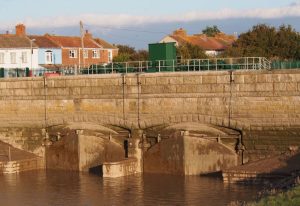
Finally water needs to be discharged into the sea, although the sea must also be kept at bay. The River Brue flows into the sea at Highbridge. Here “Highbridge Clyse” (also spelt Clyce) keeps the sea out. A clyse is a large flap valve (or “door”) which allows water to flow through it in one direction but not the other. Thus when the tide is lower than the river water is discharged by gravity. As the flood tide rises the flaps are forced shut and the river cannot flow again until the ebb tide drops below the river level. During this period a “tide lock” is created and the river level will rise until the next period of discharge.
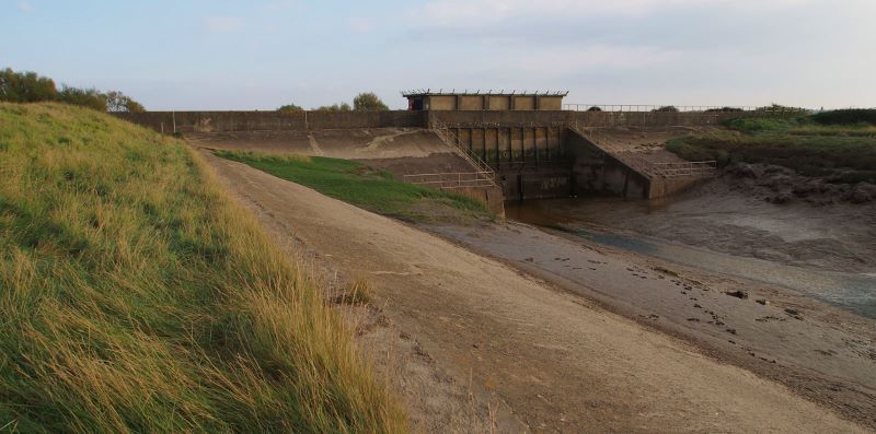
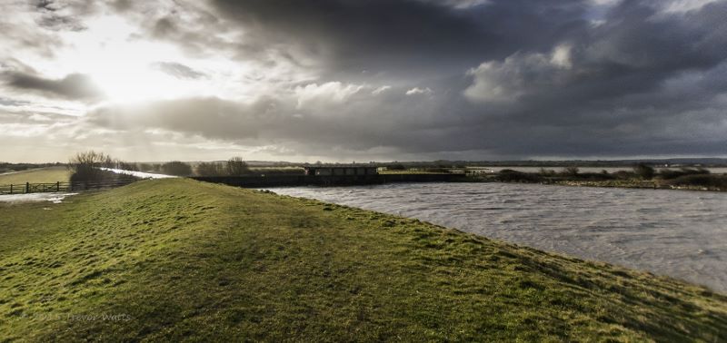
The Huntspill River operates in a different way. It is at a higher level than the River Brue and the sea. Water is pumped into it at Gold Corner and it is able to discharge water into the sea at “Huntspill Sluice” at all times other than high Spring tides. A series of sluices allow this water discharge to be controlled and prevent spring tides flowing in. The ability to control discharge is particularly important during the summer when the river acts as a reservoir supplying water back to the land via the network of rivers, rhynes and ditches.
Huntspill Sluice at high spring tide. Sea on the right at the high level, land on the left much lower. Image with thanks to Trevor Watts.
Almost the same view at low tide!